|
 Home Page |
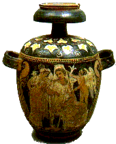
No doubts the Aeolian Islands have been populated since thousands of years - as it can be testfied by the several archeological findings shown at the Aeolian Museum of Lipari. |
 |
SALINA
 |
SALINA is separated from Lipari by a 4 Km wide, 330 m deep canal, and is formed of two mountains that meet in the Valdichiesa valley. The topmost peak, called "Fossa delle Felci", 963 m, is the highest point of the island and in fact of the whole Archipelago. Looking at it from a distance, it is easy to see why it was once called "Gemella" (Twin), because it seems to be divided into two more or less equal parts. |
| ideal spots for excursios and are very hospitable. The fishing village and the numerous natural tuff caves of Rinella are especially picturesque. A panoramic road leads to Pollara, north-west of the island, and from here the wonderful view of Punta Perciatu and the incomparable Bay can be enjoyed where the sun and the sea continually play at creating thousands of sparkling lights that flash and intermingle for an incredible coloured effect. |  |
LIPARI
| LIPARI is the chief island of the Archipelago, and administers Vulcano, Panarea, Stromboli, Filicudi and Alicudi. It is without a doubt the most complex and interesting of the islands from a geological and volcanological point of view. The various craters, whose long past activity can be seen by the presence of obsidian and pumice stone, offer the tourist a mountainous area, featuring Mount Guardia, which stands in front of Vulcano, Mount Rosa, Mount St. Angelo at the centre of the island, Mount Chirica, from the top of which the whole Archipelago can be seen, and Mount Pelato, all white with pumice, which is processed at Porticello and Acquacalda and exported all over the world from the market town of Canneto. |  |
VULCANO
 |
VULCANO, separated from Lipari by an 800 m wide canal and dominated by superb upright rocks, can be divided into three essential parts: Vulcano Piano, at a height of 400 m, is a 4 sq Km area between the Aria and Saraceno mountains, its lush vegetation dotted here and there with broom; Vulcano porto is the flat area of the port where boats and hydrofoils moor. It is dominated by the enormous, imposing Crater, still standing as it appeared after the last explosion that shook the whole island between 1888 and 1890. |
This spot, guarded and protected by the Sirens' rock, is perhaps the most evocative and restful place on the island. To the east, near the Hot Waters bubbling on the surface of the sea, there is a small sulphur and alum mountain with a pool of bubbling sulpherous mud at its foot, famous for its therapeutic effects.
Monster's Valley winds along the part facing Vulcano's Mouths, between rocks and black sands, which the progressive and continuous erosion of the wind has formed into grotesque shapes. The West coastline is a succession of precipices, inlets and marine caves that open into an unpolluted sea full of marine life.
The island offers enchanting itineries: Valle della Roia (Roia Valley); Piano dell'Arpa (Harp Plain); le Grotte dei Rossi (Rossi's Caves); la Contrada del Gelso (The Mulberry District); Capogrillo; Punte Nere (Black Points); Punta Luccia ( Luccia Point); Punta Quadrata (Quadrata Point); Scarbo; Punto Faro (Lighthouse Point); la Grotta d'Abate (Abbot's Cave) and to crown them all, the fantastic Grotta del Cavallo (Horses' Cave).
STROMBOLI
STROMBOLI is the most north-easterly island of the Archipelago.
Made of vulcanic material, its Greek-rooted name is suited to its round shape. This is the only vulcano where perennial and rythmic ereptions come from its three mouths, shooting incandescent masses and burning lapilli towards the sky, lighting up the night and rumbling into the sea to form the Sciara del Fuoco. This is an breathtaking sight, perhaps unique throughout the world, and the steady rythym of explosions brings Dante-like images to mind.
It can be admired from the sea in front of the Sciara and also from the top of the smoking cone. The fearful rivers of lava of the past are eloquently present in the precipices and irregular coast line that lend a particular atmosphere to the whole area between the Sciara del Fuoco and Ficogrande. The three villages, St. Vincenzo, St. Bartolomeo and Ginostra, all have the typical Aeolian cube shape houses, standing sparkling white on the pitch black beaches and lava covered rocks in a panoramic position. The limpid sea with its spectacular suntouched bed, that fades only slightly under the stars to soften and then glitter with colour again at the break of dawn, is the perfect paradise for fishermen.
To crown all this natural beauty the enchanting lacy peak of Strombolicchio appears in front of the island - from its top you can see the magical panorama that goes from the Calabrian Coast to the regal mantle of Aetna.
FILICUDI
FILICUDI is the penultimate island in the north-western part of the Archipelago. Its typical lush vegetation of ferns - from whence its name - encircle Monte delle Felci (Fern Mount) with an altitude of 774 m.
The small, evocative peninsula Capo Graziano rises from the south-eastern part and can be reached from Filicudi-porto. Here modern archeology has brought to light the remains of a circular hut village, dating back to the bronze age. There are three villages on this island - Filicudi Porto, Pecorini and Valdichiesa.
Its high coast line, almost at a 90° angle with the sea, offers hollows and inlets and fantastic caves, amongst which the Bue Marino cave is well worth a visit. The island is characterized by its terraces, signs of its past agricultural livelihood, and today the cultivation of capers is still flourishing. Abundant lobster, sea urchins and other fish can be caught here. And as if this spectacular nature weren't enough, the Canna, a natural obelisk, emerges from the sea and seems to touch the sky. An imposing 85 m high, it is reflected in the chrystal clear sea at sundown and in the first dawn light. Interesting archeological finds have been dug out of natural caves in Montagnola.
ALICUDI
ALICUDI is the most westerly and isolated of the Aeolian group. The peace and serenity reigning over it could suggest it as a natural hermitage.
Conical in shape, its highest point, Timpone della Montagnola, also known as Filo dell'Arpa (Harp String) emerges 670 m from the sea, in front of azure waters reflecting a fantastic variety of luminous effects created by a sequence of rocks, terraces, natural ravines and vulcanic rocks painted black and red by past explosions and lava streams.
Target of frequent attacks by pirates who infested the Tyhrrenian routes, for many centuries the population was practically forced to find natural shelter in houses built on the eastern terraces half way up the coast line.
The people here are always willing to show you smiling hospitality and can give you a breath of simple, primative life, even today. Covered in heather, which, it seems, gave it its name long ago, the island's scanty natural resources are wisely administered between terraces of plump, multicoloured Indian figs, in an almost divine silence that perhaps today can be found only on this far off, secluded, almost unearthly strip of land.
For years it has been the meeting place of amateur and professional fishermen keen on underwater fishing. In an ideal position, rich with unusual and varied fauna, they know they can be sure of finding satisfaction here.
PANAREA
PANAREA rises above a more or less circular underwater plarform no deeper than 50 m down. The little island of Basiluzzo and the reef rocks of Dattilo, Lisca Bianca, Bottaro, Panarelli and Formiche are also sited on this platform. Because of their geological nature it has been supposed that internal earth movements caused by long past explosions broke their original unity. Beneath the sea around these islands there is evidence that Panarea was continuous and that ancient civilizations lived there. The whole area can be considered unique because of the variety of rugged, irregular shapes, the succession of inlets, uncontaminated beaches and rocks which, apart from their natural beauty, seem to take on the iridescence of waters variegated by lights, restful shadows, and the whispering and sighing of nymphs and sirens.
Panarea climbs 421 m up Pizzo del Corvo and offers the tourist the hospitality of its small centres - Ditella, St. Pietro and Drauto, famous as summer holiday resorts. Cala Junco, the delightful old port of Capo Milazzese, is situated South West of the island: it is a plateau where the most ancient find of the whole Archipelago, a circular hut village dating back to 1500 b.C., was excavated. In the St. Pietro district there is a small bay for private and pleasure boats, hydrofoils and fishing vessels, and the Basiluzzo and Stromboli rock can be admired from the hill above it. Above this high rocky coastline the island is very rugged, and is more accessible from the eastern coast with its wide natural steps, suitable for cultivation.

|
Home Page |
